
Historic Opal Fields
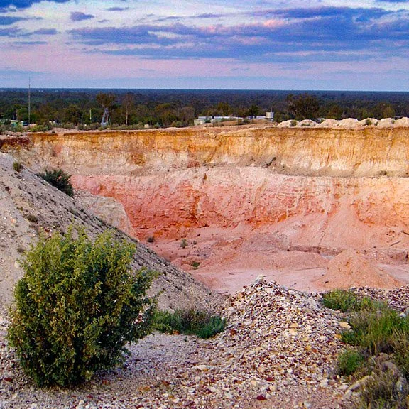
Lunatic Hill open cut on the Three Mile. (Photograph courtesy of Russell Gawthorpe.)
There are over 200 opal fields in the Lightning Ridge, Grawin, Coocoran and Mehi area. Many of them are relatively newly found, but a number date back over a century to the earliest discoveries of opal. The fields listed on this page are among the oldest and most historically significant fields. This is not at all an exhaustive list!
A: Angledool
B: Bald Hill, Bill de Boer’s, Bob Bishop’s Rush, Bourke’s (see: Paddy Burke’s), Bullock Head, Bullocky’s, The Butterfly
D: Darby’s Potch & Colour Field, Deep Belahs, Deep Four Mile, Dentist’s Hill, Dry Rush
G: The Gully
H: Hart’s & Spicer’s, Hatter’s Flat, Hawk’s Nest, Holden’s, Hornet’s Rush
L: Little Hill (see: Round Hill), Lunatic Hill
N: New Chum, New Town Hill, Nine Mile, Nobby
P: Paddy Burke’s (Bourke’s) Field, Palestine, Phil Herbert’s Field, Phone Line (see: Telephone Line), Pony Fence, Potch Point, Poverty Point, Pumpkin Flat
S: Shallow Belahs, Shallow Four Mile, Shearer’s Six Mile, Sim’s Hill, Six Mile (see: McDonald’s Six Mile, Rouse’s Six Mile, Shearer’s Six Mile, Thorley’s Six Mile), Snowy Brown & Tom Urwin’s Shallow Ground
T: Telephone Line, Thorley’s Six Mile, Three Mile, Three Mile Flat
Y: The Yank
The information on these pages has been sourced primarily from The occurrence of opal at Lightning Ridge and Grawin with geological notes on County Finch, Whiting & Relph (1958); The Lightning Ridge Book, Stuart Lloyd (1967); Lightning Ridge: Home of the Black Opal, Gan Bruce (1983), Discover Opals: Before and Beyond 2000 with Surface Indications, Stephen Aracic (1996), and oral history collected by the LRHS over many years. Refer individual pages for sources.