
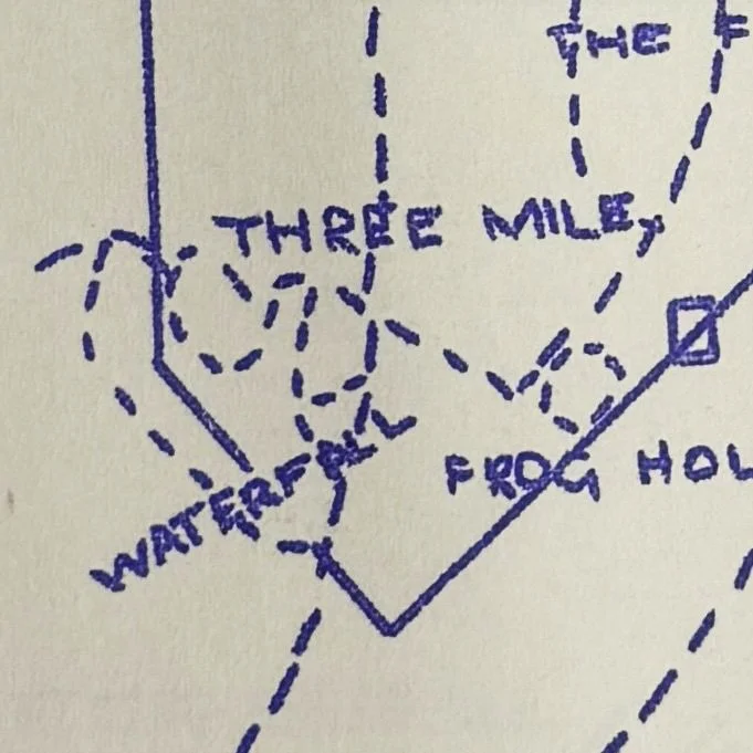
“Water Fall”
Water Fall is not a real opal field at Lightning Ridge. Rather, it is a cartographical error that has crept into multiple maps of the opal fields, likely the result of an unaware government mapmaker in the 1960s. “Water Fall” refers to the Three Mile field extension named Western Fall.
The provenance of the error can be followed through a series of maps:


Government-issue map from prior to 1952 as reproduced in The Australian Museum Magazine, Vol XI No 3, page 86, in an article by O le M Knight. This map shows “Wn Fall” just below Frog Hollow.
Government-issue map from prior to 1962 showing “Water Fall”.
Internal-use government map from prior to 1961 showing “Waterfall” in the same location.
It can be surmised that the error was translated by a government cartographer who, unfamiliar with Lightning Ridge opal fields, and likely lacking any further sources with which to clarify, incorrectly extrapolated “W(n) Fall” to be an abbreviation for “Water Fall”, either as the name of a location or as a geographical feature.
This is a fun error that still occasionally appears on maps today.
Article: Research by Russell Gawthorpe and Leisa Carney, edited by Russell Gawthorpe. LRHS research compiled by Len Cram and Barbara Moritz. Sources: ‘Lightning Ridge’, O. le M. Knight, Australian Museum Magazine, 15 September 1953, pp. 84-89; The Occurrence of Opal at Lightning Ridge and Grawin, with Geological Notes on County Finch, J. W Whiting & R. E. Relph, 1958, p. 12; NRS-9987 Mines Special Files, [9/1939.2], NSW State Archives.